Bankstown Airspace Changes – What You Need to Know come July 9th
- The Main Rotor Hub
- 3 hours ago
- 4 min read
Airservices Australia is implementing a redesign of the Bankstown (YSBK) Control Zone, reshaping how VFR pilots — both fixed-wing and rotary — access and transit the Sydney basin. The changes affect the CTR boundary itself, the structure of established VFR lanes, and the introduction of new routes. Here's a breakdown of what we know ahead of the 9 July effective date.
CTR Boundary Redesign
The lateral boundary of the YSBK CTR is being redrawn, with the zone extended to the north and west. The new boundary takes effect simultaneously with all lane and procedural changes on 9 July. Pilots familiar with the current Class D footprint should expect the airspace to look different on EFB applications — ensure your charts and apps are updated before flying.

Clearances, Flight Plans & Transponders
Flight plans are necessary for all departures from and arrivals to the Bankstown CTR that transit through Class C or Class D airspace. Clearances must be obtained from Bankstown Ground (119.9) on the ground before taxiing (or from Sydney Centre 124.55 if Bankstown Tower is closed), or if inbound, in Class G airspace before entering a CTA. Flight plans are not required for operations restricted to the YSBK CTR.
Every aircraft flying within the Class D or Class C airspaces around YSBK will receive a unique SSR code, typically assigned when a clearance is requested. This SSR code is automatically generated upon lodging a flight plan, so requesting clearance without a flight plan may cause delays. It will be mandatory to carry a working transponder (preferably Mode C or ADSB) for operations in and around YSBK.
VFR Lane Changes
All lanes below operate as Class D . You must lodge a flight plan stipulating the tracking points on the route. A clearance and discrete SSR code is required with ATC service provided by Bankstown Approach on frequency 125.80, with all routes being flown at 1500ft AMSL
Northern Lanes
Minor variation to existing Bankstown LOE paths
Muirfield Golf Club has been added as an outbound tracking point for the Hornsby Outbound lane and Castle Towers has been added as an inbound tracking point for the Brooklyn Inbound lane
HORNSBY OUTBOUND: PRT - MFGC - PENH - HSY - PAA
BROOKLYN INBOUND: BBG - CAST - PSP


Muirfield Golf Club with Castle Hill in the background
Western Lanes
PENRITH OUTBOUND: PRT - SITS - VCBR
Track outbound to Parramatta, then northwest to Seven Hills Train Station, then west to Victoria Bridge over the Nepean River at Penrith. Remain north of the Great Western Higway. Class D boundary at Nepean Hospital


LIGHTHORSE INBOUND: NPBR - LIHR - PSP
Obtaining a discrete code and clearance in Class G airspace west of Penrith, track first to Nepean Bridge (where the M4 crosses the Nepean River), then follow the M4 eastbound, keeping the M4 on your right and the Great Western Highway on your left. Pass over the Light Horse Interchange and track to Prospect, expecting transfer to Bankstown Tower for circuit joining instructions.

The Nepean Bridge - as the M4 motorway crosses the Nepean River. Inbound track runs just north of the M4

Southwestern Lanes
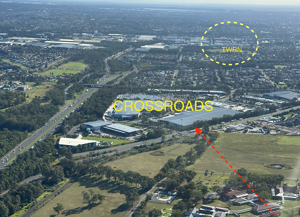
HOXTON PARK OUTBOUND: HXPR - EMPS - MAGG
Track outbound from Bankstown, crossing the Hume Highway west of Liverpool, then track to the intersection of Hoxton Park Rd and the M7. Then turn south and track to Edmonson Park Train Station (southwest of TWRN) then southbound to the west of the Hume Motorway to Mount Annan Botanic Gardens Greenhouse.


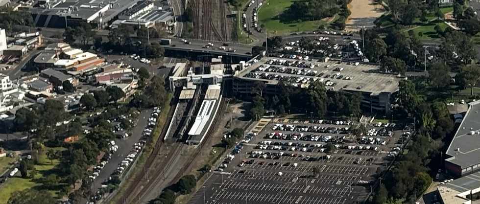
ST HELENS INBOUND: SSKP - CRST - CRSC
Obtaining a discrete code and clearance in Class G airspace south of Campbelltown, track via St Helens Skateboard Park, Campbelltown Railway Station and then north along the railway line, diverging to the Crossroads Shopping Centre, expecting a transfer to Bankstown Tower for joining instructions


Accessing Sydney Harbour
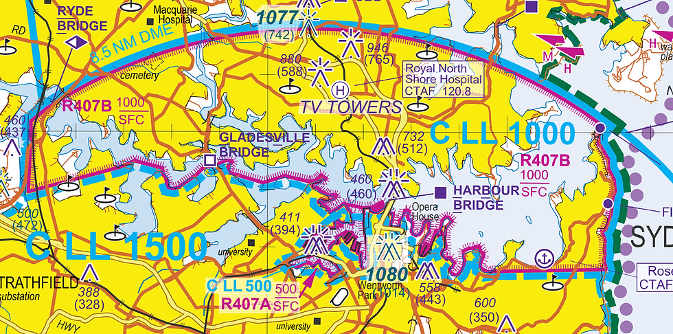
The existing route to and from Ryde Bridge for access to and egress from the Parramatta River and Sydney Harbour will remain for helicopters and seaplanes. R405 will be re-coded as R407 on 9 July, with the CLL west of the Harbour Bridge being raised to 1000ft, although at this stage the laneway between Ryde Bridge and Harbour Bridge will still be flown at 500ft
Access to and from Ryde Bridge will be via direct contact with Bankstown Tower, using the existing Choppers West (CWST) and Choppers North (CNTH) tracking points.
What about Choppers South (CSTH)?
At this stage it seems that the Choppers South tracking point will remain defined, but will not be in regular use by rotary aircraft other than emergency services
Traffic Deconfliction
Visual separation of traffic in Class D will be the pilot responsibility, with traffic information provided by ATC where possible. Two main areas of concern are:
Crossing Penrith Outbound and Brooklyn Inbound routes north of Prospect Reservoir
Fixed wing and rotary wing aircraft tracking in the same lanes at 1500ft, with significant speed differences
As yet there are no published risk mitigation strategies from Airservices Australia for these concerns
The Main Rotor Hub will continue to update this article as further information is released by Airservices Australia. The ERSA Local Procedures for YSBK will be the authoritative source — pilots should check the effective-date ERSA prior to any flight in the area after 9 July 2026.
If you have any questions or information to add, please reach out through the contact page.
Comments